Travel and hiking maps of Giglio island
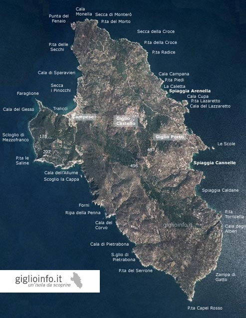
Guide to the island of Giglio, Tuscany, with travel maps and satellite map
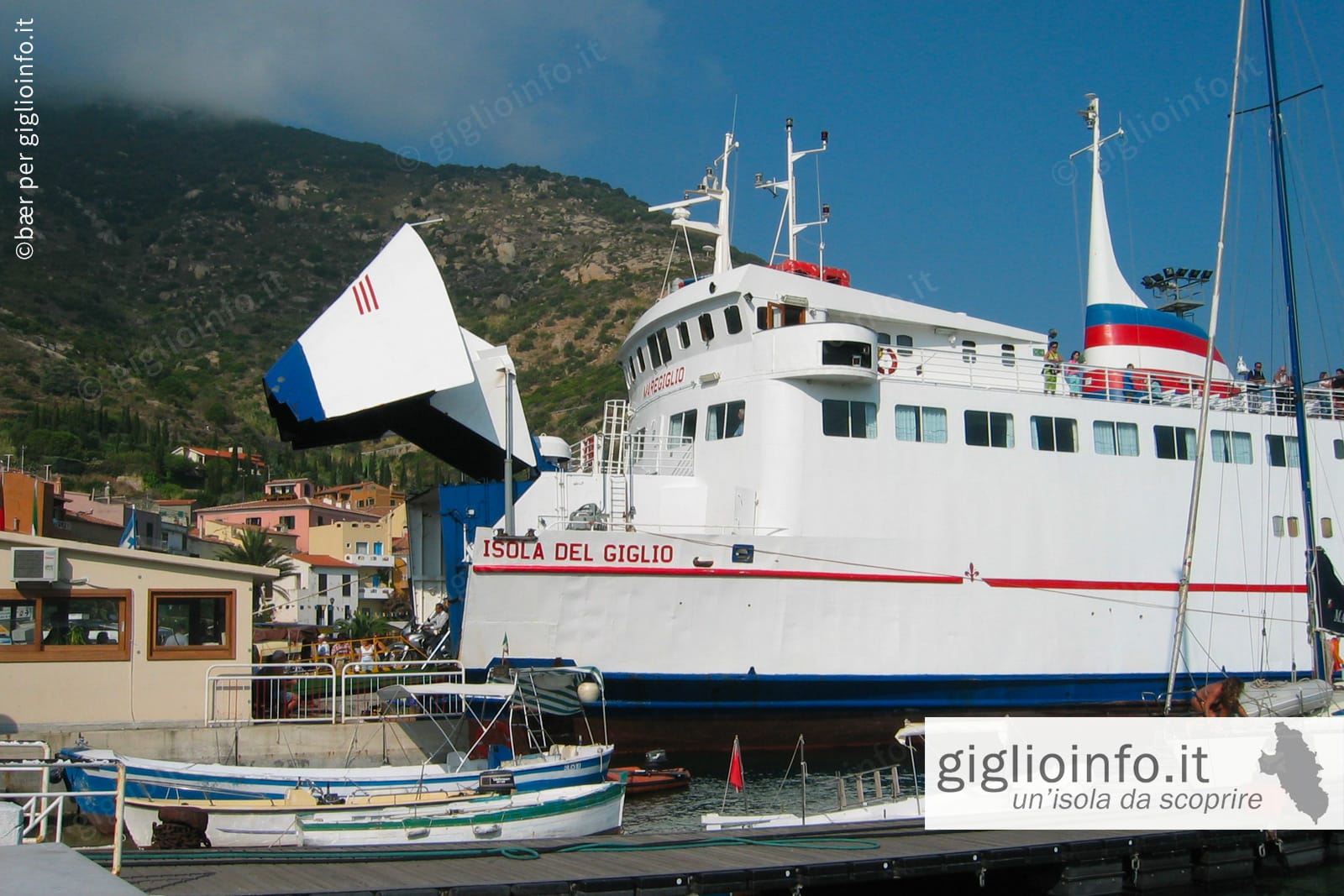
Giglio Island
The Island of Giglio is the second largest island in the Tuscan Archipelago after Elba. It covers an area of approximately 21 square kilometres, is 8.3 kilometres long and 4.7 kilometres wide, with the highest point being Poggio della Pagana at 496 metres above sea level. The 28 kilometres of coastline offer sandy beaches, small coves and impressive cliffs.
.
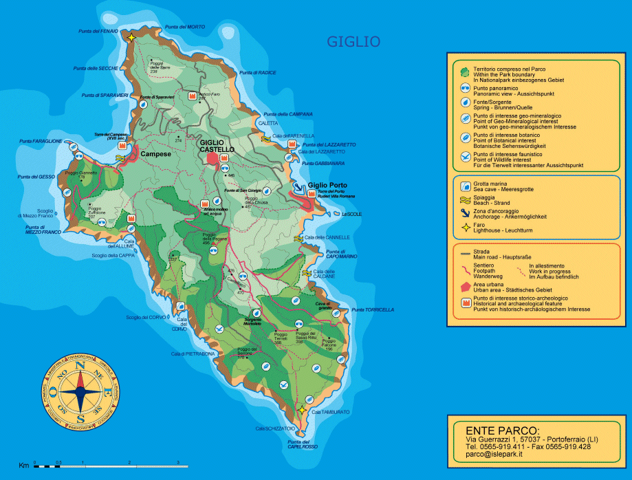
The three villages of Giglio Porto, Giglio Castello and Giglio Campese, as well as the southern tip of the island, are connected by about 22 kilometres of roads. Most of the roads run through Mediterranean scrub, vineyards and pine woods, with breathtaking views of the sea and the Tuscan archipelago.
Advertisement
Trekking Map
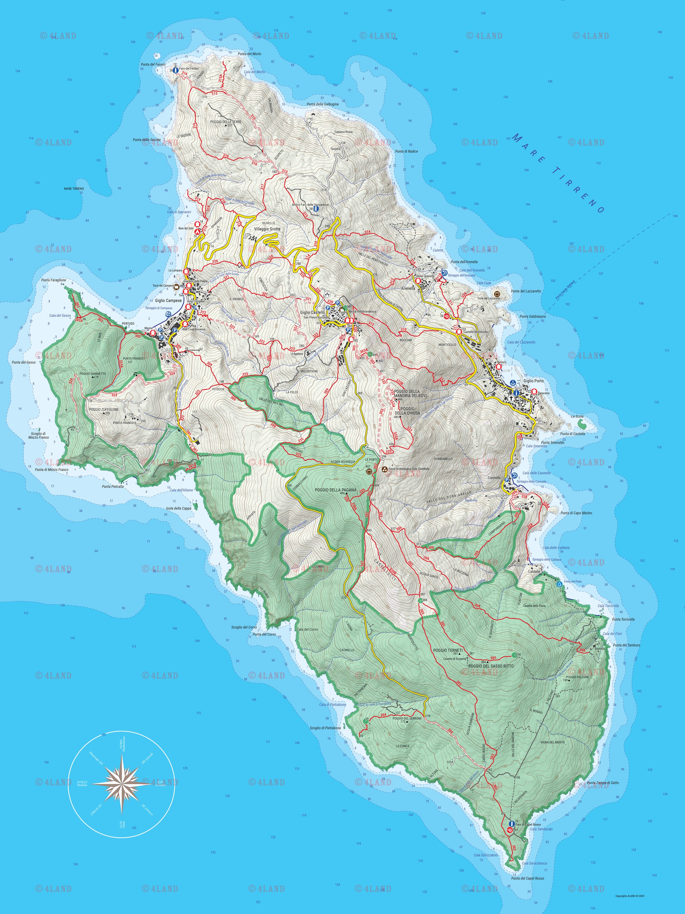
Hiking on Giglio
With 90% of its nature still unspoilt, the island invites you to discover it along the numerous hiking trails, away from the hustle and bustle of the beaches. Immersed in the scent of the Mediterranean maquis, you can enjoy spectacular panoramic views of the Tuscan archipelago and the mainland almost all the way.
Some of the paths that link the villages or lead to the fields are ancient donkey trails (Mulattiere). Other paths lead to secluded coves and beaches of rare beauty, where you can spend a day in peace and quiet.
Hiking map to download
Advertisement
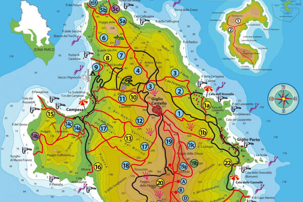
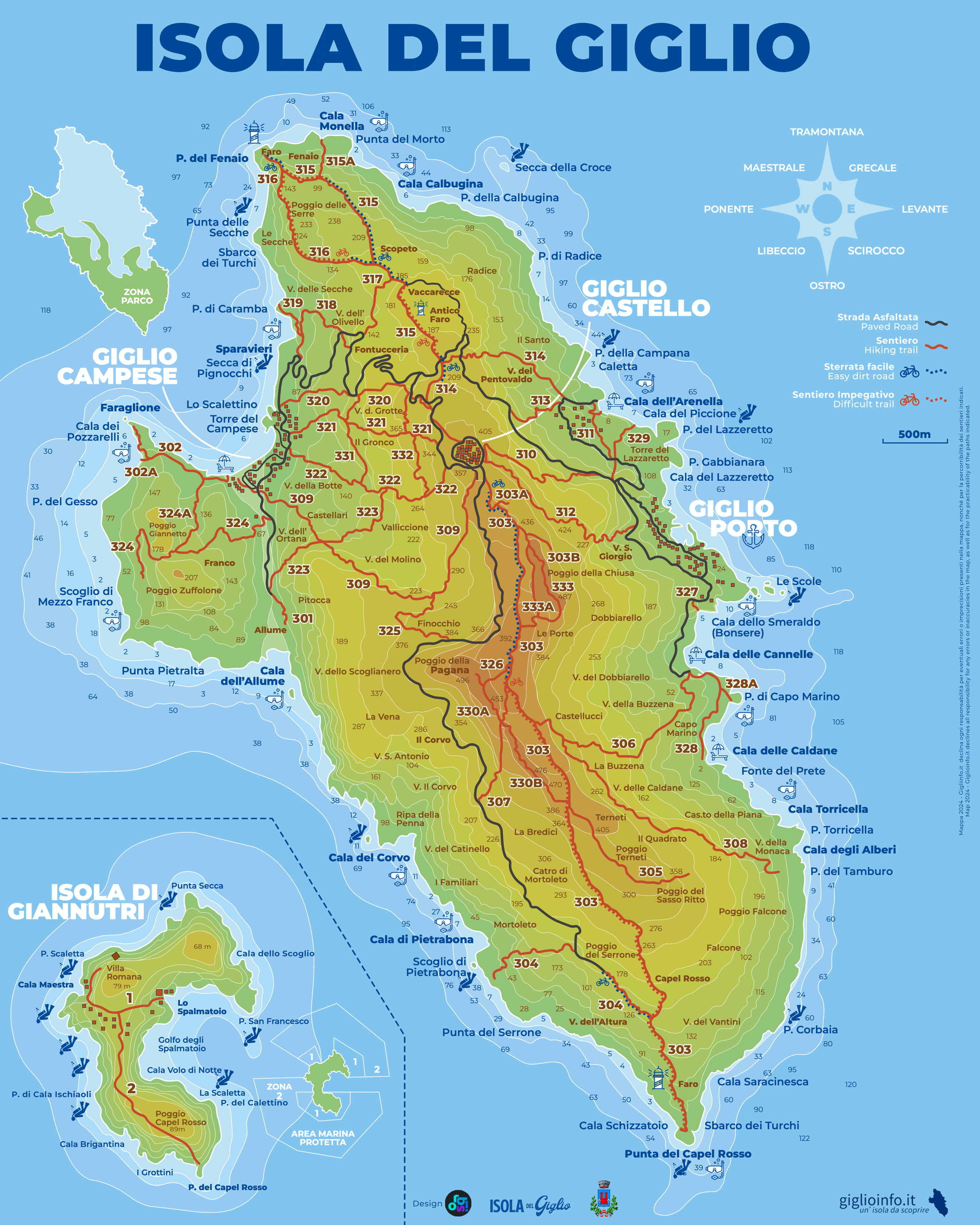
Giglio Island Map
GiglioAdds


Distrances of the island of Giglio
- Giglio Porto -> Giglio Castello: 5.8 km (10 min.), altitude difference 415 meters
- Giglio Porto -> Giglio Campese: 8.3 km (14 min.), highest point 246 meters
- Giglio Castello -> Giglio Campese: 5.9 km (11 min.), altitude difference 415 meters
- Giglio Castello -> Capel Rosso southern tip: 6.3 km (11 min.)
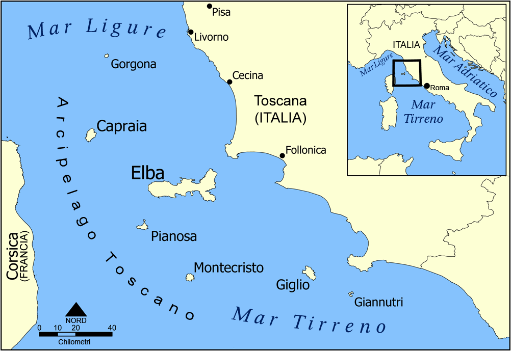
- 7.8 nautical miles (13.9 km) – Monte Argentario peninsula
- 8.5 nautical miles (15.7 km) – Giannutri island
- 27.9 nautical miles (51.7 km) – Elba island
- 36.3 nautical miles (67.2 km) – Pianosa island
- 23.9 nautical miles (44.3 km) – Montecristo island
- 59.2 nautical miles (109.6 km) – Corsica
Pubblicità
Other Maps of Giglgio
National Park on Giglio
The protected areas of the ‘Parco Nazionale Arcipelago Toscano’ national park on Giglio are almost exclusively on land, and for the most part in the southern half of the island. In addition, a few small islets have been included in the park: Le Scole, Scoglio del Corvo and Isole della Cappa. The resto of the sea is not part of the park and is therefore not protected. The following activities are allowed:
- fish
- navigate
- access
- stay
- anchor
- dive
Google Maps
you are here:
Home » Home » Explore Giglio Island » Maps
Weather Forecast Giglio Island
Webcam Giglio
Giglio Porto
Campese Beach